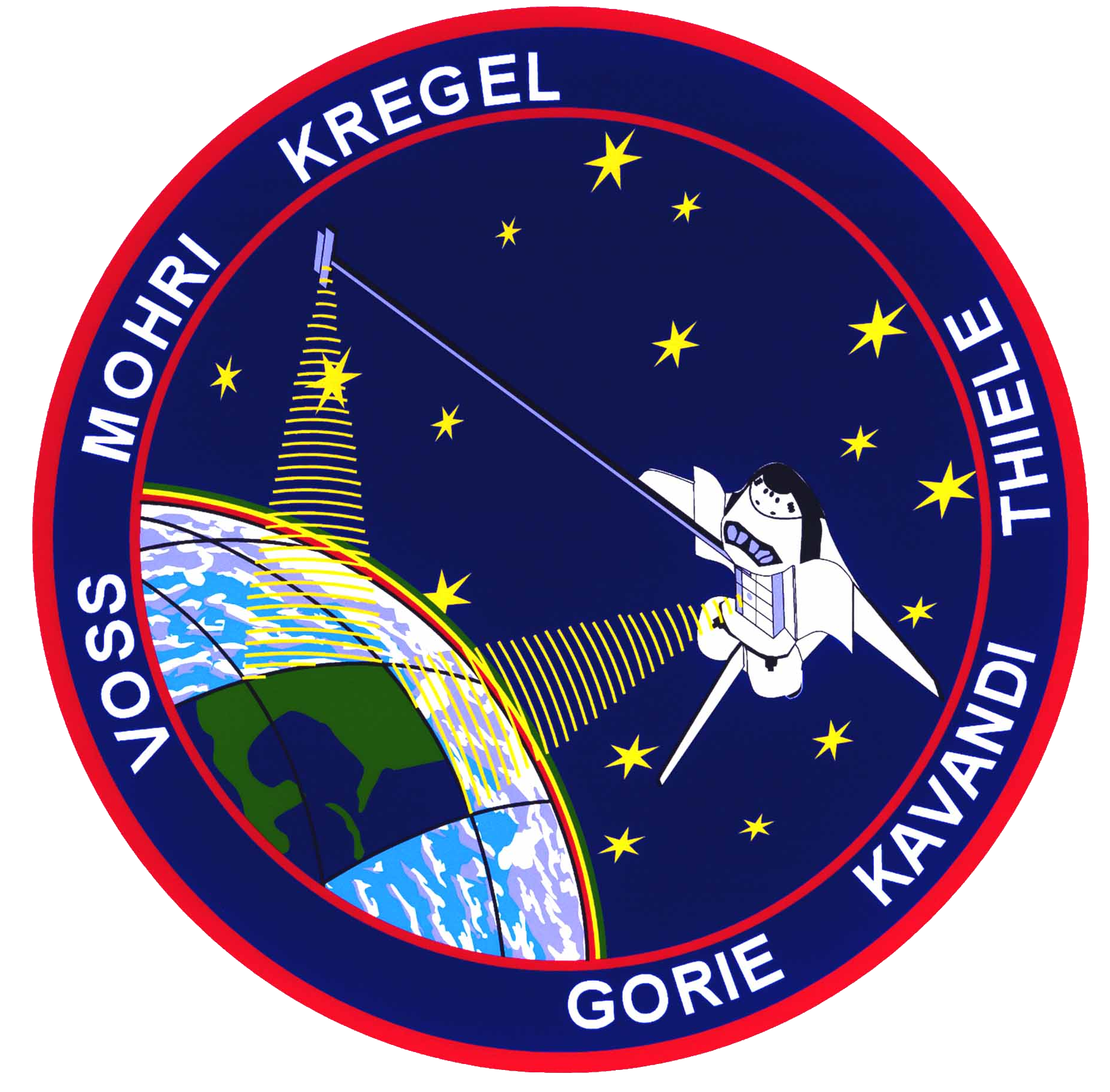
Episode 185: STS-99 - Here Comes The Boom (SRTM)
Table of Contents
On STS-99 we’ll be studying the Earth in a whole new dimension, using fancy radar tricks to scan nearly the entire planet in 3D! Close and lock your visors and put on your 3D glasses now!
Episode Audio #
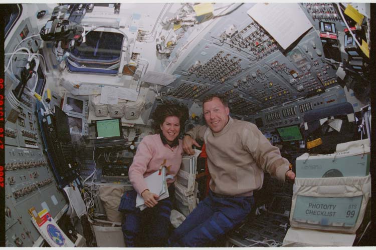
Photos #
For more photos, head over to our friends at Wikiarchives.space: https://wikiarchives.space/index.php?/category/625
Post-Flight Presentation #
To see the mission in motion, check out the post-flight presentation!
Click here for full video details.
Dreamtime.mpg #
I can’t emphasize how much this blew my mind, watching it around 2001, even on a 1024x768 display.
Video clips #
These clips were cut from the post-flight presentation, so if you want to see them in more context and with the crew adding commentary, check out the post-flight presentation above.
A shot of the SRTM boom beginning to deploy.
Zero-G dancing looks like fun!
The movement of the antenna on the boom during the fly-cast maneuver. Doesn’t it look weird? I think it looks weird.
The advanced “slam dunk” tape change technique!
STS-99 had a really picturesque landing, soaring through the sunrise.
EarthKAM #
The website is still up! https://www.earthkam.org/ek-images
Space Shuttle Stories #
If you haven’t already picked up a copy of Tom Jones’ book “Space Shuttle Stories” you can find it over at Penguin Random House and in bookstores everywhere!
Transcript #
NOTE: This transcript was made by me just copying and pasting the script that I read to make the podcast. I often tweak the phrasing on the fly and then forget to update the script, so this is not guaranteed to align perfectly with the episode audio, but it should be pretty close. Also, since these are really only intended to be read by myself, I might use some funky punctuation to help remind myself how I want a sentence to flow, so don’t look to these as a grammar reference. If you notice any egregious transcription errors or notes to myself that I neglected to remove, feel free to let me know and I’ll fix it.
Hello, and welcome to The Space Above Us. Episode 185, Space Shuttle flight 97, STS-99: Here Comes the Boom
Last time, we talked about the third visit to the Hubble Space Telescope, STS-103. Squeezing in at the very tail end of the millennium, Space Shuttle Discovery lifted off to help repair the ailing telescope, which had lost enough gyroscopes that it had to cease science operations and be placed into safe mode. And yes, I know that technically the new millennium started in 2001 but I don’t care, I’m a zero-index kind of guy. And regardless of when the new millennium may have technically started, Discovery’s onboard computers were staring down a potential Y2K bug, resulting in a cut EVA and a somewhat truncated mission to ensure that everyone was back on the ground when the new year rolled through. But even with one of the four planned EVAs cut, the mission was a success, and Hubble was able to return to its science mission.
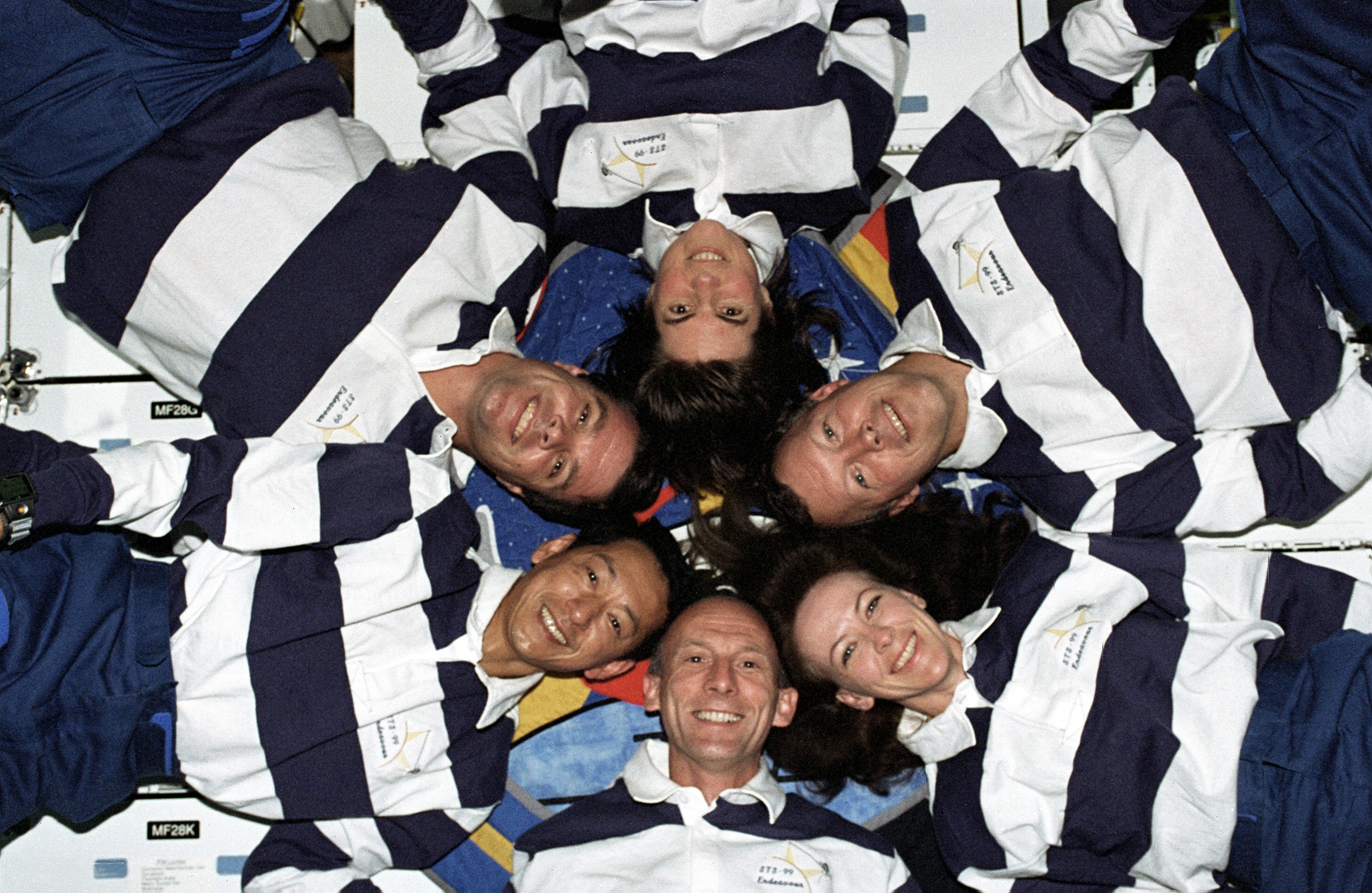
For today’s mission, we won’t be going to the Hubble Space Telescope or even to our new favorite home away from home, the International Space Station. In fact, this is one of only two remaining shuttle missions to not go to Hubble or the ISS. So rather than spend a bunch of time on the ground explaining the plan, we’re gonna do that thing where we just hop right in and get going. So let’s meet the crew!
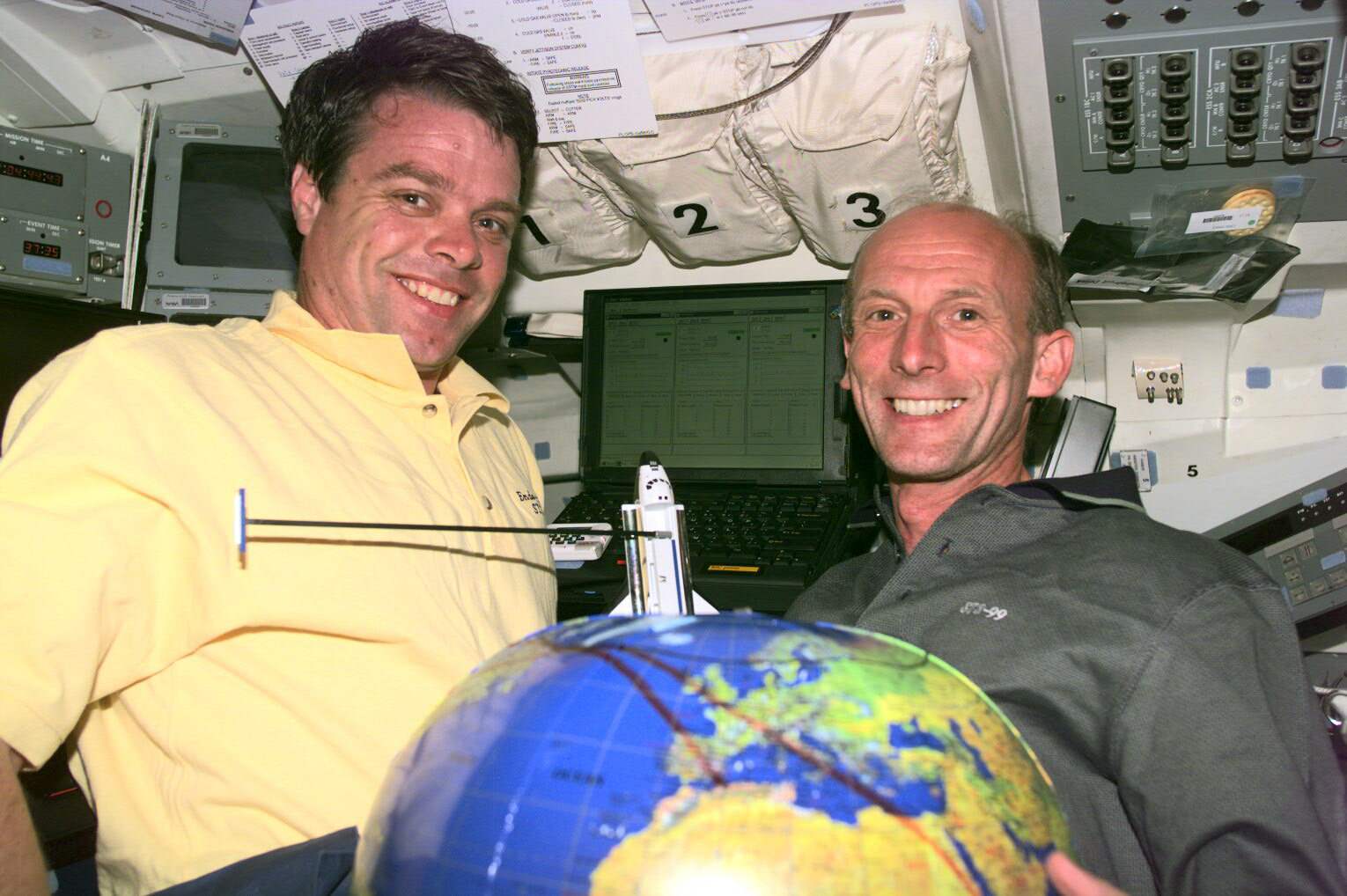
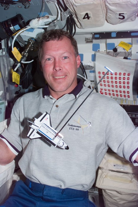
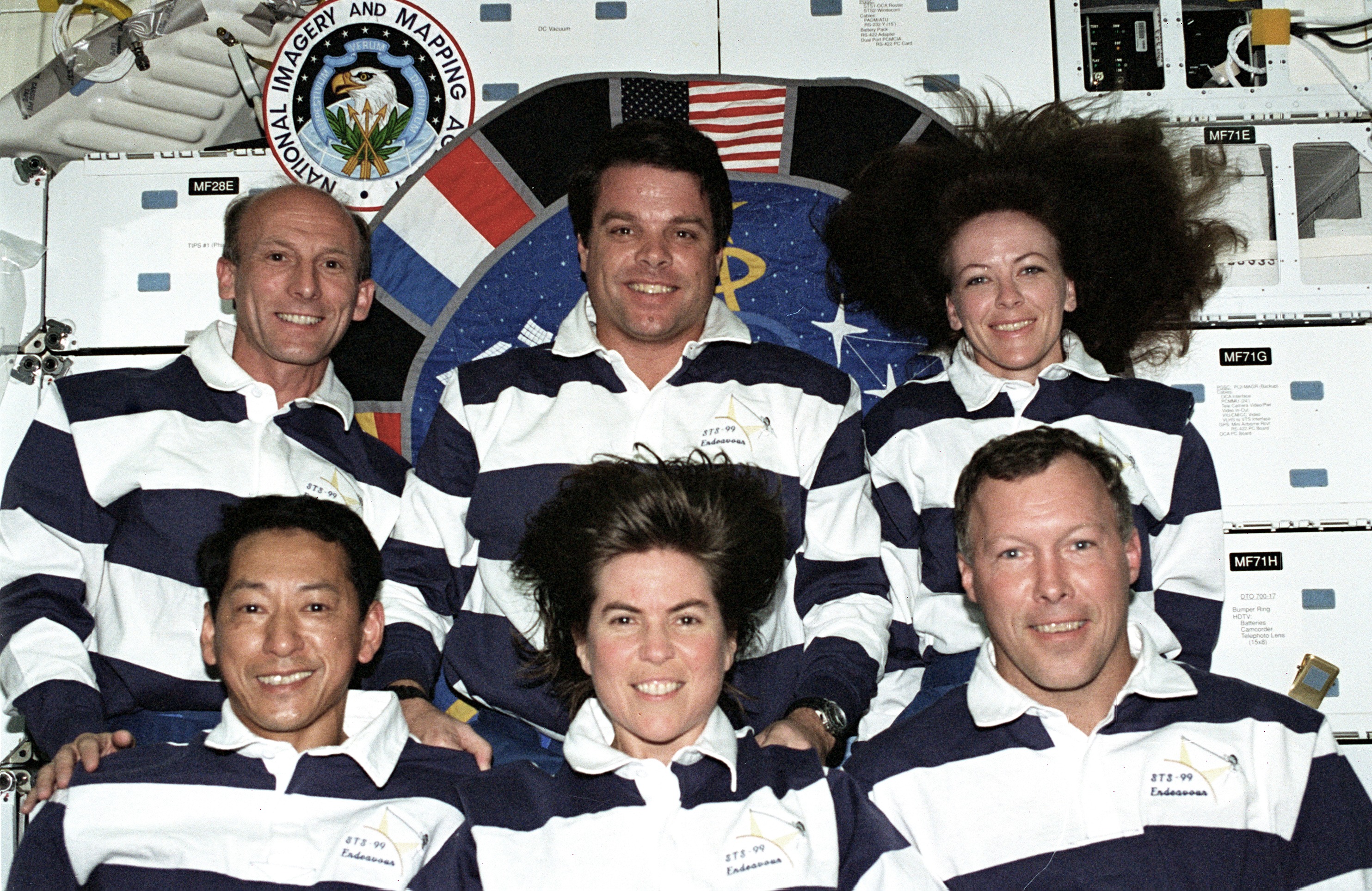
Commanding the flight was Kevin Kregel. We know Kregel from a few flights now, most recently as Commander of Space Shuttle Columbia on STS-87. That flight saw the rocky deployment and successful retrieval of the SPARTAN platform, performed a bunch of microgravity experiments, and deployed that delightful little camera drone AERCam Sprint. This is Kregel’s fourth and final mission.
Joining Kregel up front is today’s Pilot, Dom Pudwill Gorie. We know Gorie as the Pilot from STS-91, which docked with Mir to retrieve Andrew Thomas, making it the last Shuttle mission to the Russian Space Station. Today’s mission won’t see Gorie helping usher the Orbiter to a space station, but it’ll see another variety of precision flying. This is Gorie’s second of four flights.
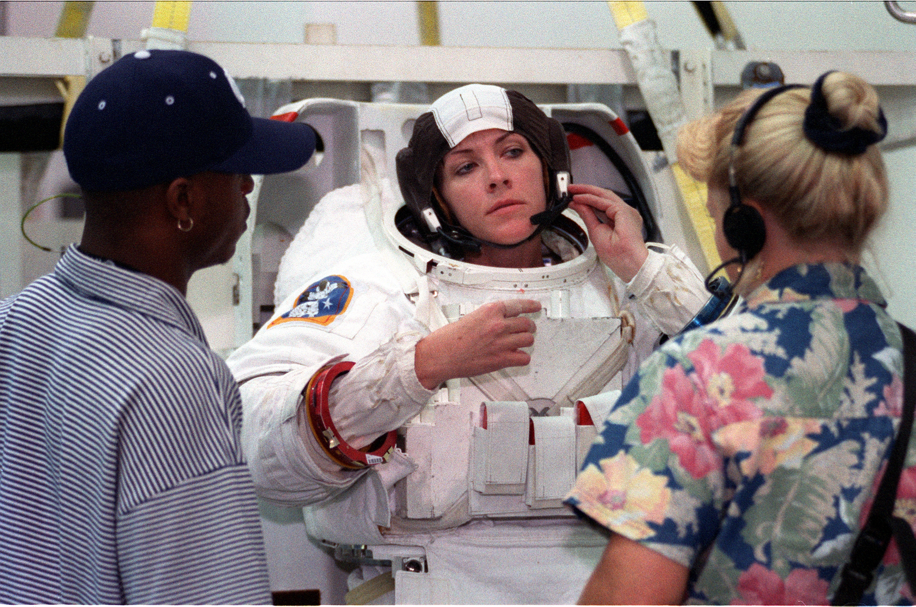
Sitting behind Gorie for ascent was Mission Specialist 1, and our lone rookie for this mission, Gerhard Thiele. Gerhard Thiele was born on September 2nd, 1953 in Heidenheim-Brenz, Germany. Eight years later, he was one of the countless people who were captivated by the flight of Yuri Gagarin as the Russian became the first human to fly in space. Gagarin’s flight made an impression, and little Gerhard decided he too wanted to fly in space, but first he had some work to do. He studied physics at Ludwig-Maximilians University in Munich, and then at Ruprecht-Karls University in Heidelberg, ultimately earning a doctorate from the Institute for Environmental Physics at Heidelberg University. Along the way, he was an operations and weapons officer on fast patrol boats while serving with the Germany navy. He began training for spaceflight in 1988, serving as a backup Payload Specialist for STS-55, the second German Spacelab mission. In 1996 he was selected to be trained as a full Mission Specialist and here he is on his first and only flight.
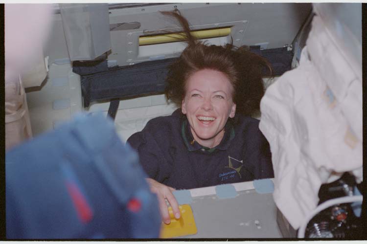
Sitting beside Thiele is today’s flight engineer, Mission Specialist 2 Janet Kavandi. We last saw Kavandi not too long ago, flying on STS-91, which also had Dom Gorie as a Pilot. This is her second of three missions.
Moving downstairs, we meet a frequent flyer on the shuttle, Mission Specialist 3 Janice Voss. We most recently saw Voss flying on STS-94, which was the reflight of STS-83, which was cut short by fuel cell problems. Today she’ll be wrapping up seven years of flying in space, since this is her fifth and final mission, rounding out a career which started all the way back on STS-57.
And last but certainly not least, Mission Specialist 4, Mamoru Mohri. We know Mohri from his role as Payload Specialist 1 on STS-47, the Japanese Spacelab mission over seven years earlier, so he’s had quite a wait for his second flight. In the meantime, he’s been trained as a full Mission Specialist and is ready to get to work on this, his second of two flights.
STS-99 had the misfortune of being delayed several times through no fault of its own. It was originally slated to lift off in September of 1999, but after the near disaster of STS-93 in July of that year, the entire orbiter fleet was stood down for extensive wiring inspections. This was especially problematic for STS-99 since the mission’s payload had already been loaded into Space Shuttle Endeavour’s payload bay, so it had to be carefully removed before the inspections could even begin. STS-99 was again delayed, and even lost its spot in line, when the Hubble’s failing rate sensors necessitated STS-103 launching as soon as possible. All this pushed the flight into the new year, near the end of January 2000.
Just as a side note, I have to mention that it is really surreal for me to be talking about the year 2000 as quote-unquote “history”. By 2000 I was a teenager and I have clear memories from this time, as opposed to the murkier occasional recollection of moments from the 90s like hearing about the delay of Shannon Lucid’s ride home from Mir. So it’s bizarre that a time period I not only experienced but can easily recall is now “history”. That said, I’m sure some of my older listeners who have clear memories of missions all the way back to the 1960s, are chuckling and smiling, welcoming me to the club.
Anyway, the first Shuttle launch of the new millennium had a little longer to wait, because on January 31st, 2000, Endeavour had to stand down from its launch attempt. First, the weather was bad, but even if the weather was good the launch would have been scrubbed anyway due to a malfunctioning Enhanced Master Events Controller, or EMEC, sending unusual signals. The EMEC is a 30 kilogram device about the size of a toolbox, that is responsible for some critical events during ascent like arming and firing the pyrotechnics that separate the SRBs and External Tank. It’s so important that each orbiter has two of them and you really don’t want them giving weird signals. Engineers tried to figure out what could have caused the unexpected behavior and determined that the only issues that could cause the anomaly would be critical problems. So even if they weren’t exactly sure what critical problem, it had to be replaced, delaying the mission again.
Almost two weeks later, it was time to try again. It looked like the flight might be on track for another scrub when a few hours before launch, folks at the Kennedy Space Center noted an unexpected drop in pressure in the Orbiter’s hydraulic system. Again, the hydraulics are an absolutely critical system since that’s how the Orbiter’s control surfaces are articulated. So without hydraulics, there’s no control, which means there’s no mission. Thankfully, it was soon determined that this drop in pressure was actually normal, given the sequence of flight control actuator tests they had performed, so it was nothing to be concerned about, though it did add a 13 minute and 40 second delay to liftoff.
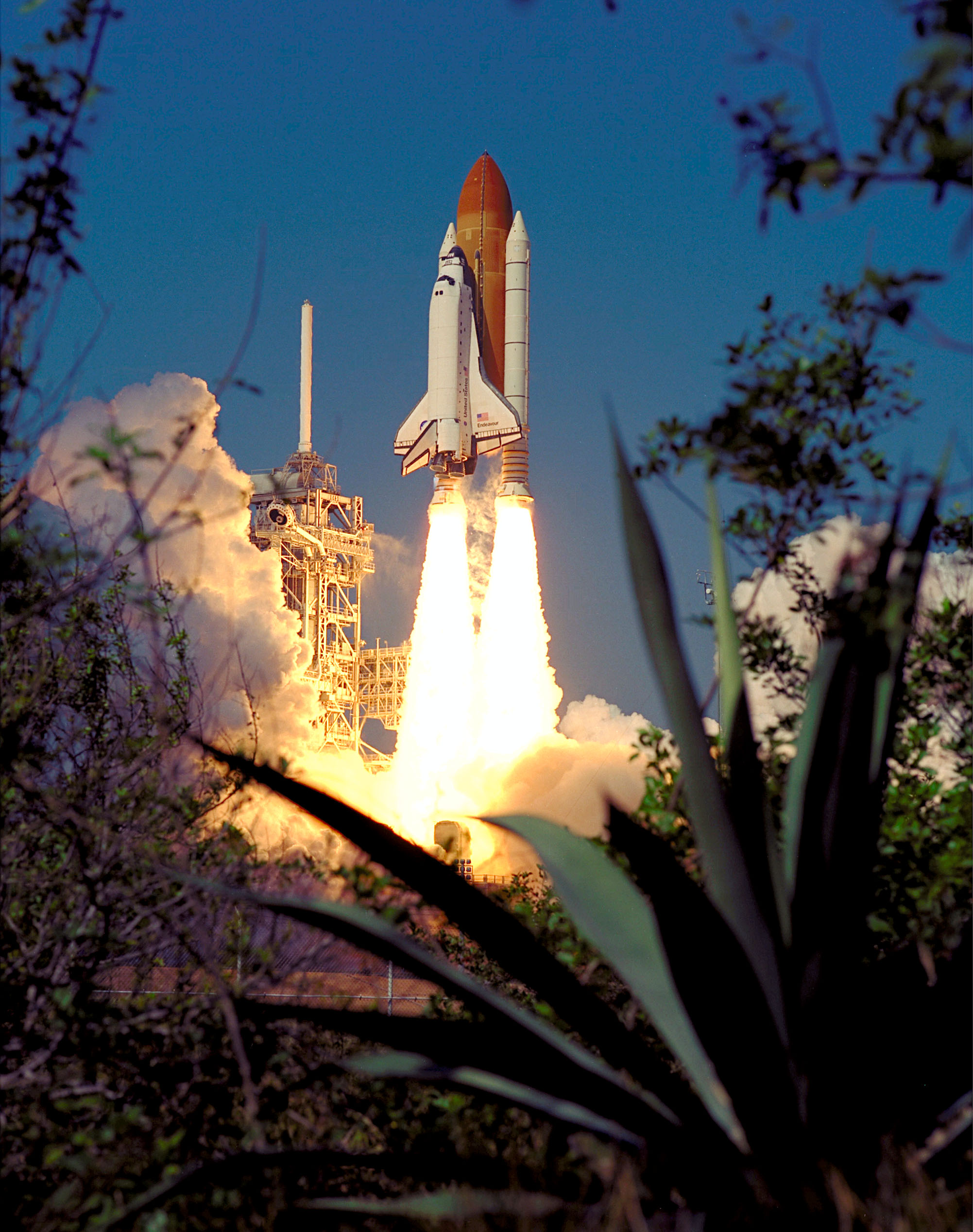
But finally, on February 11th, 2000, at 12:43 and 40 seconds PM Eastern Standard Time, Space Shuttle Endeavour lifted off for the 14th time, kicking off a new millennium of human spaceflight. Later, mission commander Kevin Kregel said “When the solids light you really know that something significant in your life has happened.. you’re just not sure if it’s good or not.” Well after an uneventful ride uphill, and arrival in a 57 degree inclination orbit, I think we can safely say it was good, Kevin.
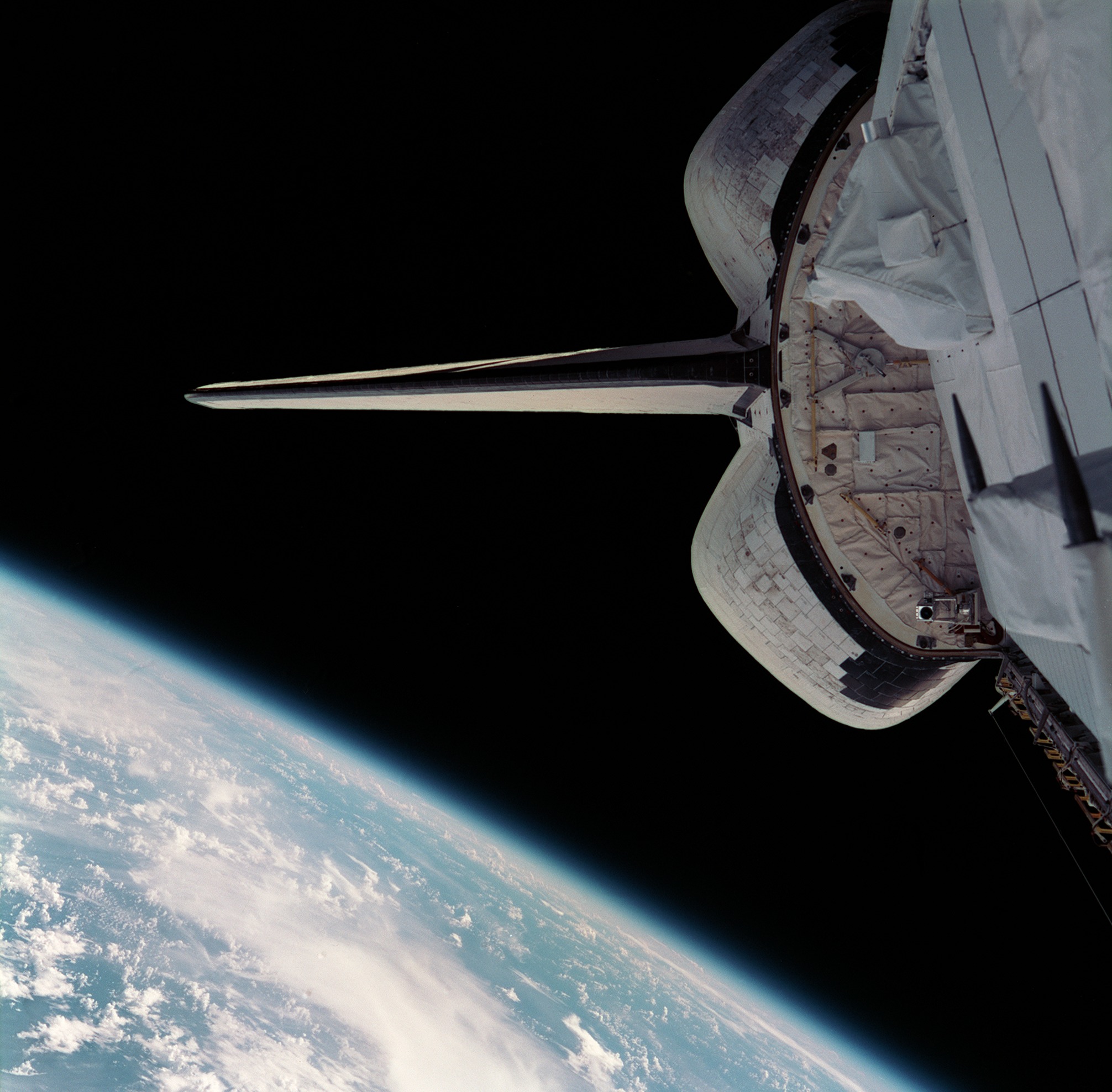
Well now that we’re up here, I suppose it’s time to take a peek out the aft windows and see what we’re going to be doing. The first thing you may have noticed as you look out the windows is that Endeavour was in an unusually low orbit, only 233 kilometers. The second thing you may have noticed is that the equipment in the back half of the payload bay looked very familiar. Or at least, it would if you were Tom Jones and had flown with it on STS-59 and STS-68. That’s right, the Spaceborne Imaging Radar, or SIR-C, and the X-Band Synthetic Aperture Radar, or X-SAR, are back! Ahh, this explains the low altitude and high inclination. Yup, the Space Shuttle would once again be doing its part to study our home planet, bouncing radar pulses off of the Earth and collecting them in an effort to make a map of an enormous swath of the planet’s surface, this time as what’s being called the Shuttle Radar Topography Mission, or SRTM.
As you’ll recall, this is actually just the latest in a whole series of radar-based payloads for the Space Shuttle. The first was alllll the way back on STS-2, though when I checked my script for that episode it seems that I inexplicably did not mention it at all. Though to be fair, there was a whole lot going on in that mission. Back then, SIR still stood for “Shuttle Imaging Radar”, with Space Shuttle Columbia carrying SIR-A. This was a much more limited instrument which relied on rotating the entire Orbiter in order to point the radar antenna at a desired target, but it proved that the concept was worth pursuing. A few years later on STS-41G we saw SIR-B, which was the same basic concept but now had its own little swivel platform so it could steer on its own, independently of the Shuttle. And then of course we had the Shuttle Radar Laboratory on STS-59 and again on STS-68. One part of the Shuttle Radar Laboratory was SIR-C, a huge upgrade from SIR-B since instead of a single antenna being physically tilted around, it was a whole series of flat antennas that, when activated in a specific sequence with some clever timing, could use constructive and destructive wave interference to point and swivel a radar beam electronically, all with no moving parts in the antenna itself. Joining SIR-C as part of the Shuttle Radar Laboratory was the Italian-made X-SAR, which brought additional capabilities to the mix. SIR-C scanned in the C-Band, with a wavelength of 5.6 centimeters, and X-SAR scanned in, you guessed it, the X-Band, with a wavelength of 3 centimeters. These two instruments, flown at different times of the year on two different shuttle missions, were incredibly successful and provided new insights into our planet.
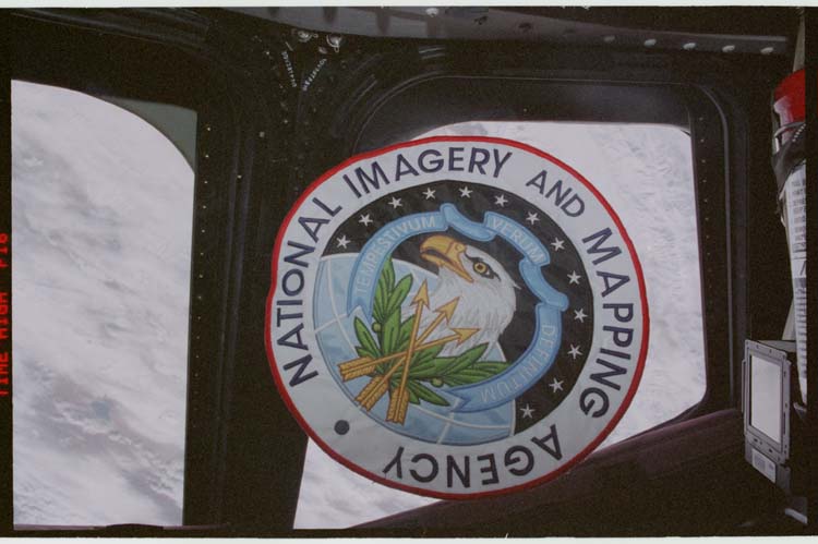
They’re flying again today in partnership with the German Aerospace Center, Italian Space Agency, and the United States National Imagery and Mapping Agency, or NIMA, which these days has morphed into the National Geospatial-Intelligence Agency, or NGA. The NGA’s job, once wildly oversimplified by me right now, is to create maps for use by the military. We’ll get into some of the specific applications in just a bit, but suffice it to say that if you want to be a military superpower, having good maps is essential. This partnership is interesting since there was a time that the Department of Defense looked like it wanted nothing to do with NASA, but here they are working together again. But I guess that makes sense. Good maps are useful for science and for military applications. In fact, the goal here was to maintain what the US intelligence community called “global information superiority”. If you know more than your adversaries you have an inherent advantage. Hence the DoD’s interest.
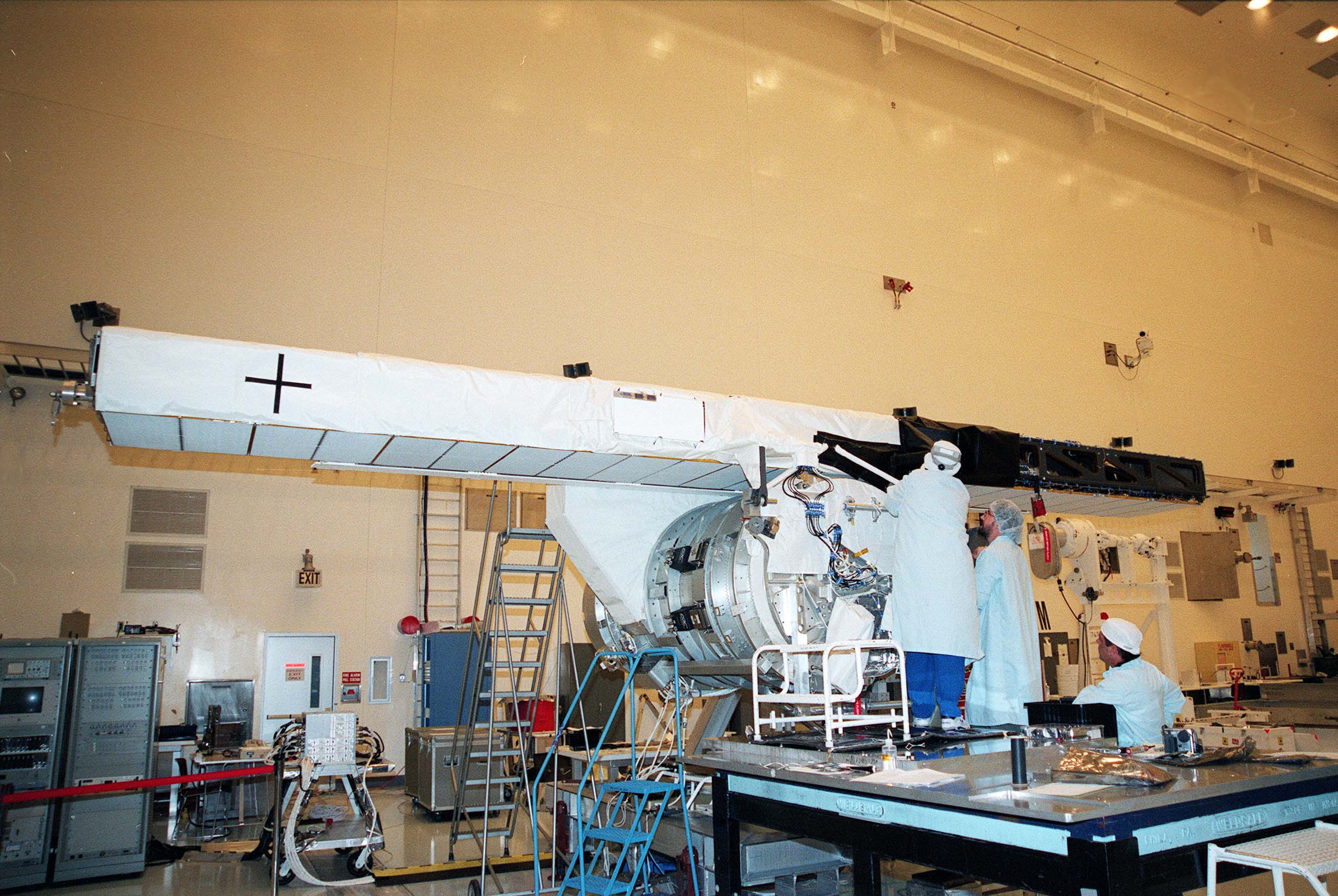
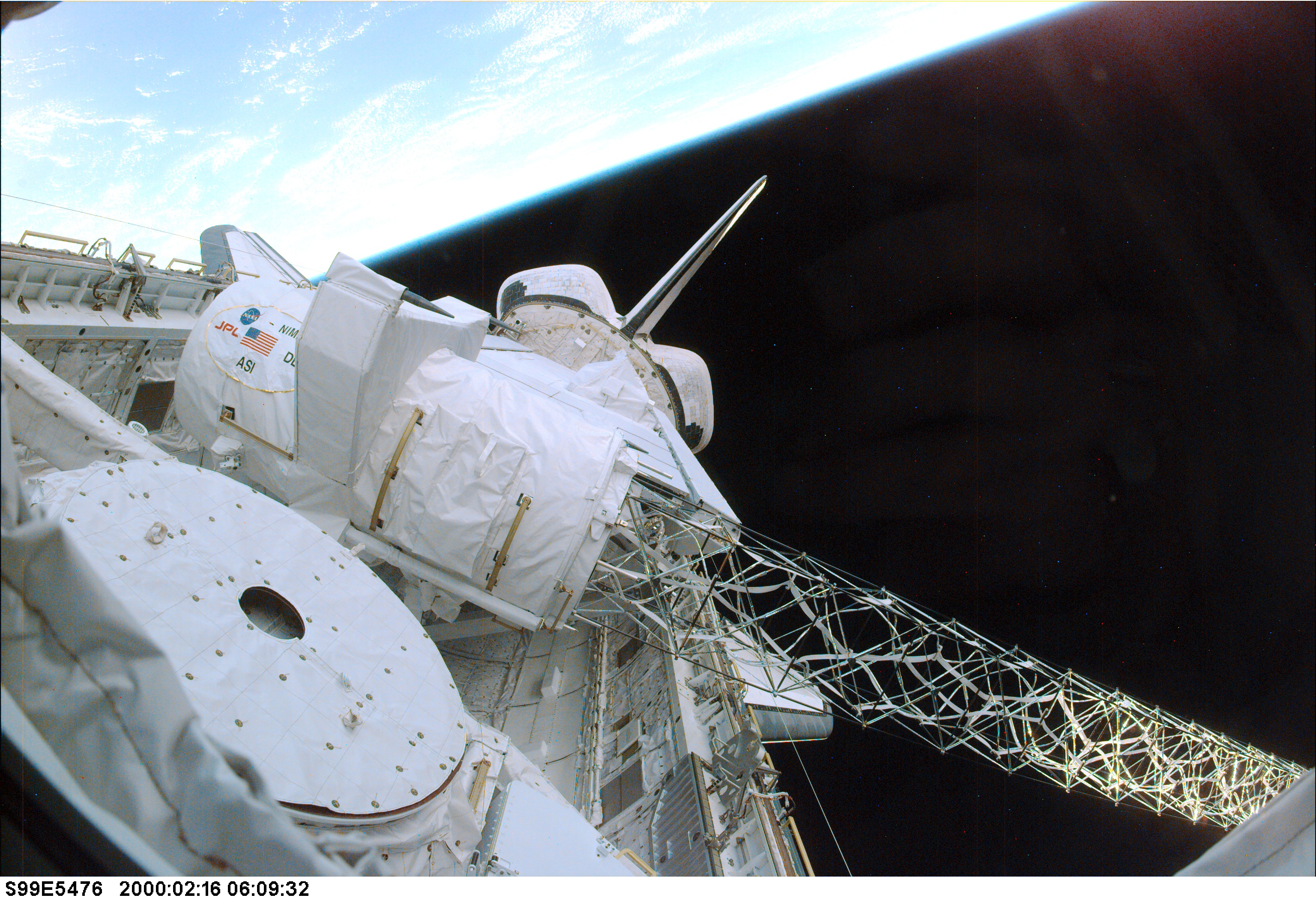
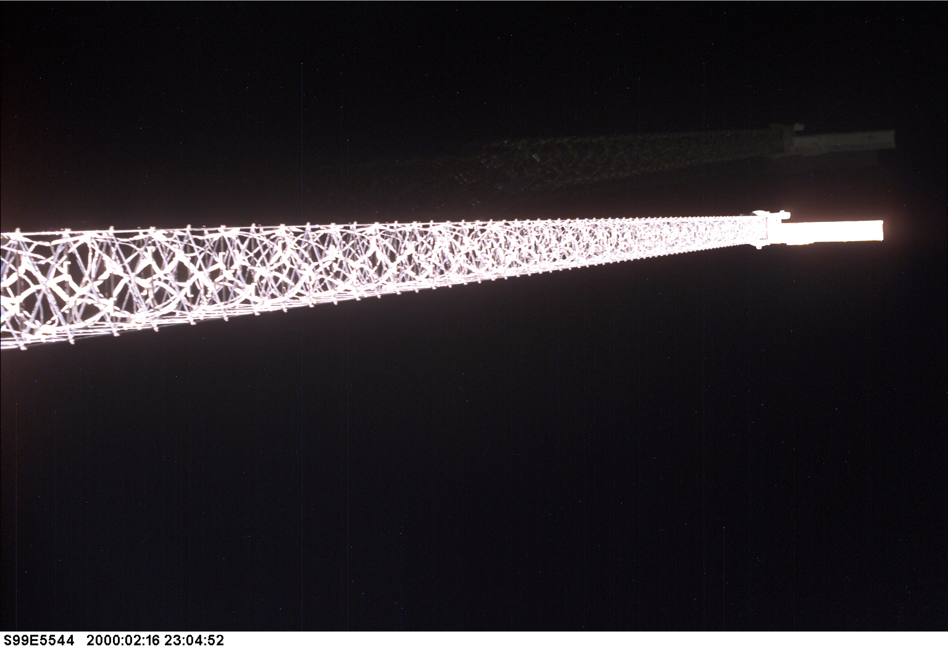
OK, so, why though? We’ve already run this mission twice, right? And synthetic aperture radar can see through clouds so it’s not like they’re worried about missing spots that weren’t visible earlier. Well, the difference lay in the forward part of the payload bay, closer to the crew cabin, in the form of a large cylinder, about a meter across and a little under three meters long. Once the payload bay doors were opened and initial checkouts were complete, Janet Kavandi and Gerhard Thiele executed a procedure in the cabin and suddenly things begin to change outside. The structure mounted to the port side of the cylinder separated from the rest, pushed out on a skeletal metallic structure. Over the next 20 or so minutes, the metallic structure continued to grow and grow until it was an incredible 60 meters long, longer than one and a half entire Orbiters. Or in American units, 65.6 yards, just barely shorter than the longest field goal in NFL history. Yes, a field goal counts as an American unit of measurement, we’ll use anything as long as it’s not SI units. 11 hours and 47 minutes into the mission, this unique apparatus began to map the surface of the Earth but with one key difference from last time, something I have yet to mention: it was scanning the Earth.. in 3D.
Ahhh, now we can see why the name of the mission has the word “topography” in it! OK, we’ll get into how this works in a minute, but first let’s talk about why this was important enough to warrant its own dedicated Space Shuttle flight. Believe it or not, in February of 2000, there did not exist a single cohesive high quality three dimensional map of the entire surface of the Earth. Thanks to the Magellan probe we literally had better 3D maps of the surface of Venus than the Earth. Sure, some parts of the world were extensively mapped, particularly any countries that were especially high tech. But there is a lot more to the world than a small handful of high tech countries. So the goal of this payload, the Shuttle Radar Topography Mission, or SRTM, was to map all the land between 60 degrees north and 56 degrees south, covering 95% of the Earth’s population. If you’re curious why they didn’t go all the way to 60 degrees in the South, I checked a map and 56 degrees is where the tip of South America ends so I’m guessing that’s it.
But not only would Endeavour and its crew be mapping this enormous chunk of the Earth in 3D, they’d be doing so with unprecedented level of detail. The resulting product, at the end of all this flying and after around a year of analysis, was a map that was 30 times more dense than existing global maps: a grid of elevation data points, each only one arcsecond apart, which is only about 30 meters at the equator. Hey that’s fun, 30 times more detailed, resulting in data points about 30 meters apart!
This map would be an incredible resource for researchers, companies, and the military. Let’s look at some of the military applications first. First, there’s obvious stuff like flight simulators. When you’re training military pilots or practicing a specific mission over hostile territory, the more accurate your simulated terrain, the better prepared your pilots are. There’s also stuff like logistical planning and air traffic management, which is important for the military since at a moment’s notice, in theory, they may have to stand up a massive operation at just about any point on the globe. Another way this data is important to the military is in the use of cruise missiles. If you’re designing a missile to hug the terrain as it flies long distances, you better know that terrain pretty well. And of course, if there are troops on the ground, understanding the exact nature of that ground is critical. Topography wins battles. Just ask anyone who’s fought at Thermopylae.
But as many military application as there are, there are even more civilian and science applications. The stuff about flight simulators and air traffic management applies just as much to civilian aircraft as to military. In fact, NIMA worked with the National Transportation Safety Board, the NTSB, during their investigation of a major civilian aviation accident. Now, the official material mentioned that little tidbit without actually saying what accident it was, but I think I tracked it down. On August 6th, 1997, Korean Air 801 ended in tragedy when the Boeing 747 crashed into a hillside in Guam. The attempted landing was at night in poor weather, and the captain became confused when his glide slope instrument seemed to respond even though the airport’s glide slope signal wasn’t supposed to be working. The result was the aircraft crashed into terrain just six kilometers shy of the airport. Reconstructing the local hilly terrain in 3D was an important part of the investigation, so I’m pretty sure that’s the accident the press kit was referencing. But let’s move on before I accidentally turn into an Air Crash Investigations podcast.
Applications of the SRTM data also includes stuff like surveying, civil engineering, land use planning, disaster recovery, and determining line of sight for communications towers. Those comm towers you see dotting the landscape don’t just talk to cell phones, they also beam communications between each other, relaying signals back to the main network. With a detailed 3D map of the Earth’s surface it’s easier to plan where to put these when designing a communications network. And of course, there’s also a ton of science applications. One fun fact I learned while researching this episode is that when valleys erode away, the surrounding mountains actually get taller since the entire area is less heavy and the buoyancy of the mantle pushes everything up!
Before learning all the physics behind the radar, let’s take a look at this boom we just grew out of the side of Endeavour. How does a 60 meter mast fit inside a cylinder only 3 meters long? To be honest, I don’t really understand the mechanism at play here, but I’ll do my best. The mast is made out of eighty-seven 112-centimeter-wide cube-shaped sections called “bays” that have some sort of tricky latch on them. Materials used in the mast included carbon-fiber-reinforced plastic, stainless steel, alpha titanium, and Invar, a material that, as the name suggests, doesn’t change shape much (or is invariable) under thermal changes. Somehow, in a way I can’t really visualize, driving a single nut with a motor causes the mast to push out and grow, eventually locking into place once it reaches its maximum extent. In fact, it was critical that it did meet its maximum extent. It’s not that they couldn’t have used the data from only 40 meters or 50 meters out, but without hitting the full 60 meters the mast doesn’t lock into place and rigidize.
Several sources made a point of mentioning that the boom was the largest rigid structure deployed in space up to that point, only being eclipsed by the ISS in the years to come. But I’m a little skeptical about that. A few times in the past, on those annoying classified Shuttle missions like STS-51C and STS-33, something was deployed that may have included the Magnum electronics intelligence spacecraft. We are straying way outside of known fact here and into internet speculation, but if the diagrams I’ve seen of Magnum are to be believed, it would comprise a gigantic unfolding radio dish that was up to one hundred meters in diameter. Beyond the range of the even mightiest field goal! But since the DoD likes to keep their secrets, it’ll be decades before we know for sure.
Also, fun fact, the mast was made by the same people who made the mast for the Tethered Satellite System. Now, before you panic, let’s just remember that the mast worked fine on TSS, it was the tether that had issues.
Alright, so that all sounds great, but how do we actually generate the data? At the end of that long mast is a 360 kilogram structure that holds the key to this mission: two additional radar receivers, one for C-band and one for X-band. It’s time to learn about interferometric synthetic aperture radar, or InSAR.
OK, so first, there’s regular old radar, short for radio detection and ranging. A radio antenna emits a pulse of radio energy, which is just very low frequency light. That pulse bounces off of stuff, and the antenna listens to hear the echo. By carefully measuring the timing of the echo it’s possible to figure out how far away something is and by analyzing the echo it’s possible to learn something about the properties of the object the pulse bounced off of.
Then there’s synthetic aperture radar, which we’ve seen a few times now. In synthetic aperture radar, the radar antenna is mounted to a vehicle, and uses the fact that the vehicle is moving to make it as if the radar antenna was physically bigger than it is, which gives it better resolution. When we saw this technique on previous missions, the Shuttle would emit a pulse of radio energy which would bounce off the surface of the Earth and return to the Shuttle. Since different materials scatter the radar in different ways (especially once you start adding polarization into the mix), it’s possible to make maps that highlight stuff that isn’t necessarily obvious in an optical map. Flat things tend to reflect the radar really well, so they’re either black because the radar pulse is reflected in some random direction and doesn’t come back to the Shuttle at all, or they’re very bright cause it bounces directly back like a mirror. Wet things reflect the pulse differently than dry things. The dimensions of the stuff on the ground also matters, since the radio waves are pretty long, and will be affected differently by things that are close to their size. Plus, since radio waves will happily fly right through cloud cover and don’t rely on sunlight, it’s possible to make maps through clouds, at night, or even on cloudy nights. Pretty useful stuff.
Interferometric synthetic aperture radar, or InSAR, takes all this to the next level, or rather, the next dimension. The radio pulse is still emitted by the main antenna in the payload bay, but the echo is now received by both the main antenna and the auxiliary antenna at the end of the boom. Now, 60 meters is pretty big for a structure in space, but it’s pretty small compared to the hundreds of kilometers between the Orbiter and the ground, especially since the pulses are sent out at an angle, not just straight down. So the echoes received by the two antennas are very very similar, with similar timing, strength of response, and so on. But there’s one key difference: the phase. The phase of a wave refers to where in the repeating pattern of the wave we are. That is, are we at its peak? Are we in the middle? Are we at its trough? With InSAR, the waves arriving at each antenna had to take a slightly different path, with slightly different lengths, so you get two very similar waves that are slightly out of phase with each other. If you combine these two waves you can create and interferogram. The resulting interferogram will cancel out most of the backscatter and just leave the phase difference caused by the different paths taken by the radar pulses. Once you have that, you know the length of each side of the triangle made up by the two radar signals and the 60 meter boom. Put another way, once post-processing is complete, we can see the ground in three dimensions. Just recapping that quickly, the Shuttle sends out a radio pulse, receives it with two antennas spaced 60 meters apart, mixes the signals together, which reveals how far away the target on the ground is with extra precision.
If part of that sounded familiar, it should. We know interferograms from Episode 132, where we talked about the flaw in the Hubble Space Telescope mirror. The Hubble mirror was measured using a reflective null corrector, which used a similar technique to generate a similar interferogram, which made the minute details of the Hubble mirror surface visible. Now, just as a quick reminder, I’m no radar or optics expert so I could be mistaken, but if I understand correctly, the Shuttle was basically doing the same thing as the reflective null corrector, but with the entire surface of the Earth. So instead of looking for tiny variations in the surface of the mirror, we’re looking for tiny variations in the surface of the Earth. But since the Earth is pretty big, those tiny variations end up being like.. mountains and stuff.
With the reflective null corrector in your mind, you might see a potential pitfall with this setup: the resulting data is extremely sensitive to the geometry of the instruments. With Hubble, one component of the reflective null corrector was out of position by 1.3 millimeters, which meant their measurements were wrong. Well that’s just as big a concern on STS-99. If the measurements of the length of the boom were wrong by only 2 centimeters, or 0.03% of the entire length, the resulting error in altitude measurements would be off by a whopping 120 meters. So it wasn’t good enough to just extend the boom and call it a day. The instrument package at the end of the boom contained a couple of GPS receivers, which would carefully measure their distance relative to other GPS receivers in the payload bay. But it also contained some special lights which would be watched by a star tracker situated in the payload bay. The star tracker didn’t know that this LED wasn’t actually a star and just tracked it with extreme precision like it always does. This way the precise length of the mast and position of the auxiliary antennas could be recorded, resulting in higher quality data. On top of that, the altitude of the Shuttle itself would be tracked to about one meter precision, and its attitude would be tracked to within one arcsecond. With that level of precision you could point at a dime from two miles away. Or in metric speak, you could point at an 18 millimeter circle from about three kilometers away.
One other really cool thing about interferometric synthetic aperture radar is its potential to track processes over long periods of time. This doesn’t really apply to STS-99 but I’m not going to have a chance to talk about InSAR again so I’m just gonna briefly get into it here. The whole way that InSAR works on this flight is by emitting one pulse and receiving the echo in two slightly different locations, which allows scientists to cancel out the similarities and highlight the differences, which in this case yields altitude data. But does it have to only be altitude? What if instead of displacing the second antenna in space we displaced it in time? If you were able to return to the same precise spot and emit the same precise radar pulse in the same precise direction, and then diffed the resulting signal from one you recorded earlier, you’d cancel out everything that didn’t change and highlight everything that did. And these images can be taken seconds, minutes, months, or even years apart. Suddenly you’re able to clearly see stuff like how vegetation has changed, or how the side of a volcano is bulging, or how the ground around a seismic fault has shifted. Now, in the case of something like tracking a volcano bulging you’d probably be better served by putting a bunch of GPS receivers directly on the mountain so you can get continuous high precision data. But you can’t have GPS receivers everywhere all the time, and satellites can cover a lot of ground.
We’ve actually seen this displaced-in-time technique used a little bit on the previous Shuttle radar missions. You may recall that we talked about this on the STS-68 episode, the second flight of the Shuttle Radar Laboratory. On that mission, Endeavour retraced its own steps, flying ten meters to the side of where it had flown on the previous radar mission. By flying the same path, but ten meters to the side, they could combine the data from the previous mission and it was almost as if they had a second antenna on the end of a ten meter boom. The tradeoff here is that the data was going to be way more messy. STS-68 flew months after STS-59, so it wasn’t a given that everything on the ground was exactly the same as it had been. Plus, remember how even slight changes in geometry could lead to big errors in the data? Well, flying a spacecraft to within a few centimeters of where it was months ago is no small feat, and neither is measuring its location with that level of precision. So this “repeat-pass” interferometry is a handy tool to have in the toolbox but is going to be messier than collecting both echoes at the same time. So the fact that the Shuttle was flying this “single-pass” imaging radar was a pretty big deal.
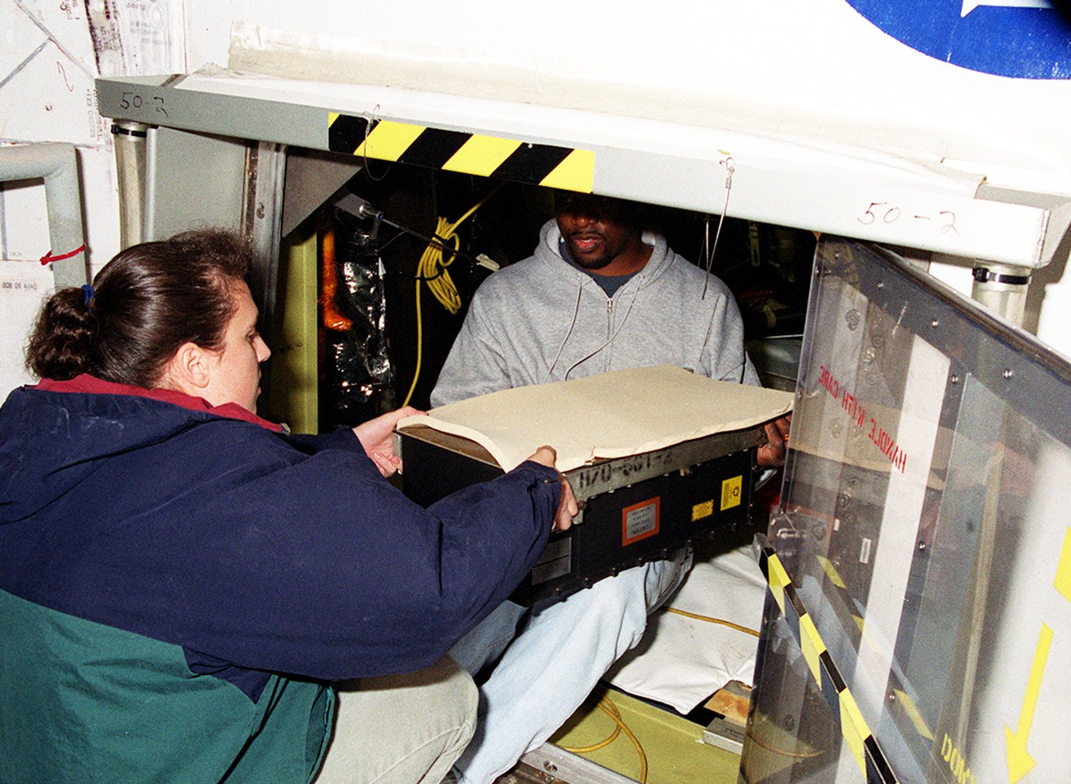
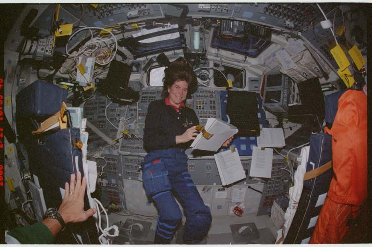
OK great, so, that’s all pretty fascinating, but where does the crew come in? As usual, the crew has a lot of stuff to keep them busy, but one of the main jobs of this mission was changing tapes. The SRTM payload recorded data at about 34 megabytes per second (that’s bytes, not bits), which is about four times faster than TDRSS can handle. So while some data was transmitted to the ground during the mission, most of it was recorded to 332 magnetic tapes, not too dissimilar from VHS tapes. The raw data was piped through a payload computer which directed it to one of three onboard tape recorders, so one would always be ready to go. When a tape filled up, it would move on to the next recorder, and the crew would remove the filled tape, label it, and slot in a new one. Over and over, every half hour or so for the entire mission. To save you from doing the math, it works out to around 9.8 terabytes in total, which is a respectable chunk of data in 2024, let alone in 2000. My favorite tape change was the so called “slam dunk”, where a crew member took out a tape, pitched forward in a spin, handed off the old tape and got a new one once they were facing backwards, and then slotted the new tape in as they returned to facing forwards. I’ll include a video on the show notes page.
To save electric power and space on all these tapes, the radar would be turned off over the ocean, which is a known altitude. Since the ocean is most of the planet’s surface, that lead to some pretty convenient power and data saving. But since the ocean was a known altitude, it could be used as a baseline for the topographical data. A few minutes before flying over land, the crew would turn the radar back on and record a sample of the ocean. Then when it flew over mountains and forests and stuff, scientists could use the ocean height as “zero” use the relative difference to define what all the other heights were. This would be especially important later on when it came time to stitch together all the long strips of radar data into one cohesive map.
The crew also had a live feed of the precise distance and position of the instruments on the end of the mast, and had the ability to slightly tweak their position using a device that they called “the milkstool”. So between that and the Saturn 1B launches, there are now two space-related milkstools you can talk about.
The crew were also kept busy by a number altitude adjustment burns. Now, unlike a bunch of scifi movies and TV shows, I really do mean altitude here, and not attitude. With Endeavour in such a low orbit, barely even 230 kilometers, drag would add up quick. And it was important to maintain a specific orbit in order to properly map the entire surface of the Earth. So once a day, an altitude raise burn was planned. Normally this would be easy peasy, but.. we have one sixty meter long complication thrown into the mix this time. If the pilot crew did the altitude raise burn without taking special precautions, the heavy instrument package at the end of the boom would rock back and forth, putting a lot of stress on the boom’s structure. To get around this, the crew executed.. the perfect cast: the fly-cast maneuver.
There was no way to prevent the mast from deflecting. It wasn’t perfectly rigid so it was going to bend no matter what. But a little bending wasn’t as bad as twanging back and forth, which is what would happen if the pilot crew didn’t do something clever. So.. the pilot crew did something clever. Before the main burn they would pulse the RCS thrusters forward for about one and a half seconds, causing the auxiliary antenna to fall back by about 25 centimeters as the mast bent just a bit. But right as it reached its maximum bend, the point where it would normally bounce forward again, they would turn the thrusters back on for the main part of the burn, essentially “catching” the mast in place. The result was this sort of visually unsettling maneuver where the mast would bend backwards.. and then just stay there. I’m not sure why but when I saw the footage I thought it looked really really weird. I’ll be sure to include that in the show notes too. Once the burn was over, they would do the same thing in reverse. The burn would end and the mast would start to straighten out. Left alone, it would twang back and forth until the motion was eventually damped. But instead of leaving it alone, the crew would again blip the thrusters right as the mast was straight, basically catching the Orbiter back up with its motion, and stopping the twang.
They were clearly getting into it because Commander Kevin Kregel even brought a fishing pole and fishing hat along for the ride. Over the course of the mission they executed seven of these burns, with the eighth being canceled. Why? So glad you asked.
Before I can explain why we have to return our attention to the equipment at the end of the sixty meter boom. Along with the radar antennas and GPS receivers and star-tracker-tricker LED was a cold gas thruster. This thruster was designed to expel nitrogen gas and deliver a small continuous thrust. The reason for this thruster will be obvious to anyone who remembers the LDEF mission or the trouble with Mir when it lost attitude control: the gravity gradient. Without getting into all the math again, objects in low orbit tend to end up in an orientation with their long axis perpendicular to the ground. The longer the object, the more powerful the effect, but it’s surprisingly strong even for small spacecraft. Just ask the attitude control guys on OSAM-1. So with this sixty meter long boom sticking out of the Orbiter, the gravity gradient was constantly trying to pull Endeavour out of its desired attitude. The nitrogen thruster was there to fight against this tendency.
This was great, until on flight day two, folks on the ground noticed that Endeavour’s RCS propellant usage had more than doubled from 0.07% per hour to 0.15% per hour. Once they looked into this they realized that the cold gas thruster had failed and Endeavour was forced to pick up the slack. This was.. very– actually not that big a deal, but they did have to make some adjustments, otherwise the RCS would be used up too quickly and mapping would have to end early. First, the attitude deadband, or how far off of the nominal attitude the Orbiter could wander, was increased from 0.1 degrees to 0.2 degrees, and attitude maneuvers were allowed to take longer, both of which saved precious RCS prop.
But my favorite mitigation was a clever trick mission controllers figured out on the fly. Someone happened to notice that during a waste water dump the demands on Endeavour’s RCS thrusters were lessened. Put another way, the waste water being expelled through its nozzle was imparting a slight rotation to the Orbiter that replicated what the cold gas thruster had been doing. They were literally using a gross pee thruster to help stay on target! Armed with this knowledge, the original plan of avoiding unnecessary water dumps, so as to not disturb the attitude, was thrown out the window. So rather than keeping all the excess water generated by the fuel cells, 15 supply water dumps were added to the schedule. Between the waste water and supply water dumps, that much more RCS propellant was saved.
The ground also made the decision to remove the option of a contingency EVA at the end of the flight. This EVA had originally been planned in case the mast didn’t retract fully into its canister, but it was a tough tradeoff. By including the EVA option, mapping would have to be cut off a little early and some parts of the Earth would not be mapped after all. So now, the EVA was cut again since, if I have this right, through some mechanism I don’t understand it would help save a little RCS prop, which also allowed them to extend mapping by nine hours and collect the last of their data. So maybe the cold gas thruster failing was a blessing in disguise.
But let’s take a step back from collecting data from the surface of the Earth and instead collect some data from the early World Wide Web. When I first looked up footage of this flight as part of my research for this episode I was struck by a powerful sense of deja vu. Something about it looked very very familiar. Suddenly it hit me: it was the dreamtime video. Way back in the swirling mists of time, at the dawn of a new millennium, I was a teenager just learning how to really use computers. Sometimes this meant using programs to paste dumb ASCII art into AOL chat rooms, sometimes this meant wandering around public Unreal Tournament servers, and sometimes it meant downloading music and subtitled anime over services that rhyme with Hapster and HuZaA. But on one glorious night, it meant that a friend and I found some public FTP server that had space shuttle videos of unthinkable filesize and resolution. Hundreds of megabytes in size, and in absolutely stunning 720p resolution, these videos were almost supernatural in quality for the time. I felt like I was on the shuttle. I must have watched the videos dozens and dozens of times. Some time in the intervening years I lost the original files but I remembered the name “dreamtime.mpg” and sure enough, I found the original footage under that name on YouTube, and the mission featured was indeed STS-99.
All these years later, I learned that Dreamtime was actually the name of a company, specifically Dreamtime Holdings, that briefly existed in the early 2000s. They had partnered with NASA to sell HD footage from the ISS, and this STS-99 footage was presumably part of some kind of demo reel. I don’t really understand how this business was supposed to work, and I guess the company’s owners didn’t either cause it seems to have gone out of business around 2001.
I’ll include the footage in the show notes, but for now I’ll describe one scene just to give you an idea. Down on the middeck, in front of a big Japanese flag, Mission Specialist Mamoru Mohri had a blob of water a little smaller than a baseball floating around. He stuck a few different objects into the ball including some rice, a bit of a cookie, and a chrysanthemum flower which had some cultural significance that was lost on me. When play time was over, Pilot Dom Gorie swooped in and gulped the blob down in a scene reminiscent of that weird water monster in the movie The Abyss. It wasn’t until a few hours after he drank the water and its contents that Mohri mentioned to his pilot that the chrysanthemum flower was apparently a mild laxative. Oops.
Thanks to our buddy Tom Jones’ new “Space Shuttle Stories” book we also get a slightly less goofy story courtesy of Mission Specialist Gerhard Thiele. He recalled a particular night pass over the Pacific ocean. Even at Space Shuttle speeds it can take a while to pass over the Pacific, so with the radar off, the crew had around 35 minutes with nothing to do but take in the sights. With Commander Kevin Kregel and Mission Specialist Janet Kavandi joining him on the flight deck, they dimmed down the lights and computer screens, allowing their eyes to adjust in the dark. The Earth was a wall of black, only detectable by its lack of stars. For half an hour nobody said anything, in what Gerhard calls an almost holy moment. He spent the time staring out at the stars. He said “If you asked the astronauts, eight out of ten would say that the Earth was the special thing to look at - where they wanted to be. I wanted to be in the blackness. If I could have taken over command of the shuttle, I would have said “That’s where we are going now.””
Just another one of those incredible miraculous moments that are delivered to us on a regular basis by human spaceflight.
9 days, 14 hours, 54 minutes, and 1 second after lifting off, the mapping mission came to a close and the crew prepared to retract the boom. Over the course of the next 20 minutes the massive structure pulled in on itself, somehow disappearing into the comparatively small canister… almost. With only a few inches left to go, the retraction stopped. They turned the motors on again, but no dice, it just sat there, tantalizingly close to being stowed. Ahhh, remember that contingency EVA they added in case they had trouble with retraction, but then removed to get some extra mapping in.. yeah. Of course now that the EVA had been taken away there was retraction trouble.
There was no actual danger to the crew or Orbiter in this case, but if the mast couldn’t be fully retracted and locked into its canister, the crew would have no choice but to jettison the structure, rather than risk it coming loose and rattling around in the payload bay during reentry.
The ground considered going for a contingency EVA after all, but since the EV team, Kavandi and Gerhard, were on the other shift and thus asleep, Kregel decided to hold off on waking them up. After cranking the motor to maximum torque and trying again.. it still didn’t work. But then, finally, a second attempt at maximum torque saw the boom disappear at last inside the canister, safely contained for the trip back to Earth, no jettison required.
Before we pack up completely, I do want to briefly mention that this flight saw the return of EarthKAM, which used to be known as KidSat. EarthKAM actually made its renamed debut on STS-89 but I neglected to mention the incredible acronym that made up its name: Earth Knowledge Acquired by Middle school students. I guess they didn’t think EKABMSS was very catchy. Something else I have neglected to mention about the KidSat / EarthKAM mission is that it was actually started by none other than Sally Ride, who wasn’t flying in space anymore but was still helping to inspire kids all over the world to become the astronauts and aerospace engineers of the future.
The camera itself was a modified Kodak DCS-460 and was mounted in the starboard overhead window. With kids on the ground submitting their desired targets, the camera took an incredible 2,715 photos over the course of this mission, a record for this payload up to this date. If you’d like to see the photos for yourself, they’re still available online at the time of this recording, so I’ll include a link with this episode.
With the mast packed up and the data tapes filled, it was time to head home. It was hardly the longest shuttle flight, at just a little over 11 days, but that radar was pretty power-hungry, which limited its duration somewhat. Over the course of the mission it used around 900 kilowatt-hours, which is an awful lot for a Shuttle payload. I checked my electric bill and if we don’t count the air-conditioning-heavy months of July to September, 900 kilowatt-hours would cover any two months of my entire house’s energy needs.
So, the crew donned their suits, slewed to the proper attitude, fired the OMS engines, and prepared for reentry. After an uneventful trip scorching through the upper atmosphere, Endeavour arrived at the Shuttle Landing Facility at the Kennedy Space Center. Here it became the 58th mission to attempt DTO, detailed test objective, 805, which sought to assess the Orbiter’s performance near the upper end of the crosswind limits. 57 previous missions had failed to perform the DTO since the winds were either too calm to qualify, or too strong for the Shuttle to land in the first place. It looked like STS-99 might finally be the one lucky enough to thread the needle and get this done, but KSC wind tower data showed that conditions changed at the last moment and DTO 805 would have to wait for another day. Oh well.
11 days, 5 hours, 38 minutes, and 44 seconds after lifting off, Space Shuttle Endeavour landed in a not-quite-strong-enough crosswind and closed out a wildly successful mission.
Over the course of 222 hours and 23 minutes of radar mapping, 99.96% of the planned mapping area was visited at least once, and 94.6% was visited twice. Only around 200,000 square kilometers was missed. That sounds like a lot until you realize that most of that area was in parts of the United States that were already well mapped, and that 119-and-a-half million square kilometers were mapped in total. The 30-meter posting data of the SRTM dataset would become a staple of science, civil engineering, military planning, and all those other applications I mentioned at the top. At first, the 30-meter data was limited only to US government and US commercial use, but a 90-meter version of the data was made available worldwide. And in 2015, even the 30-meter data was fully released.
Once again, the unique capabilities of the Space Shuttle Orbiter and its dedicated crews was utilized to do critical work that benefited people all over the world.
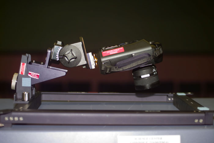
If you’d like to visit the SRTM boom for yourself, head on over to the Smithsonian Udvar-Hazy Center, go find our old buddy Space Shuttle Discovery, and just look up. SRTM and its partially extended boom are mounted to the ceiling for all to enjoy.
Next time.. we head back to the International Space Station for the first time in almost a year. The station may still be waiting on its new service module, but Space Shuttle Atlantis has a slick new flight deck to show off.
Ad Astra, catch you on the next pass.